Pyramid Peak 2012
SPORTS
NAVIGATION
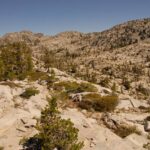
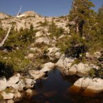
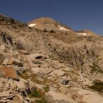
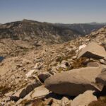
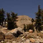
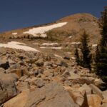
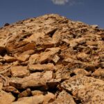
Pyramid Peak is the highest peak in the Tahoe Basin. It’s basically a hike, unless there are winter conditions. I first saw it from Mt Ralston, which is an excellent and short hike (but very steep with altitude). The approach is from Highway 50, a couple miles east of Strawberry and the famous Lover’s Leap climbing area. There is a parking lot with restrooms at the trail head. You take the well established trail north into Desolation Wilderness, to Horsetail Falls. The trail disappears at the falls, so now you’re on your own for navigating. Warning, this is an area where bad outdoor skills will get you killed. These cliffs can be navigated easily with no technical skills, but you do need to pick your route carefully. Loss of visibility in bad weather can be disastrous. I saw hikers taking totally unnecessary risks on the cliffs over the waterfalls, where a much safer passage was a little to the west.
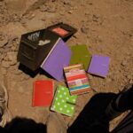
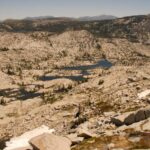
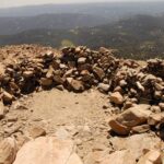
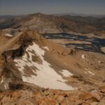
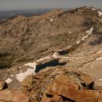
Once up to the flat parts, it was just a matter of weaving through the cliffs on the eastern flanks of Pyramid Peak. Weather on my day was perfect, with clear skies, warm and no wind. I wore shorts to the summit. Since this is no trail, it was like doing stair steppers in the gym for several solid hours. The only other hikers were a couple guys on the summit ridge. Once on the summit, there’s a bunch of cleared out areas to get you out of the wind, and this canister of journals. The best sight from up there is Aloha Lake. The main challenge is the altitude and, being summer with no snow, you’re rock hopping the whole time. Any slip up and you can have a broken ankle or leg and no easy rescue.